From major hurricanes in the U.S. and Caribbean islands to floods in India, NASA and U.S. satellites have helped countries better forecast and respond to extreme weather events.
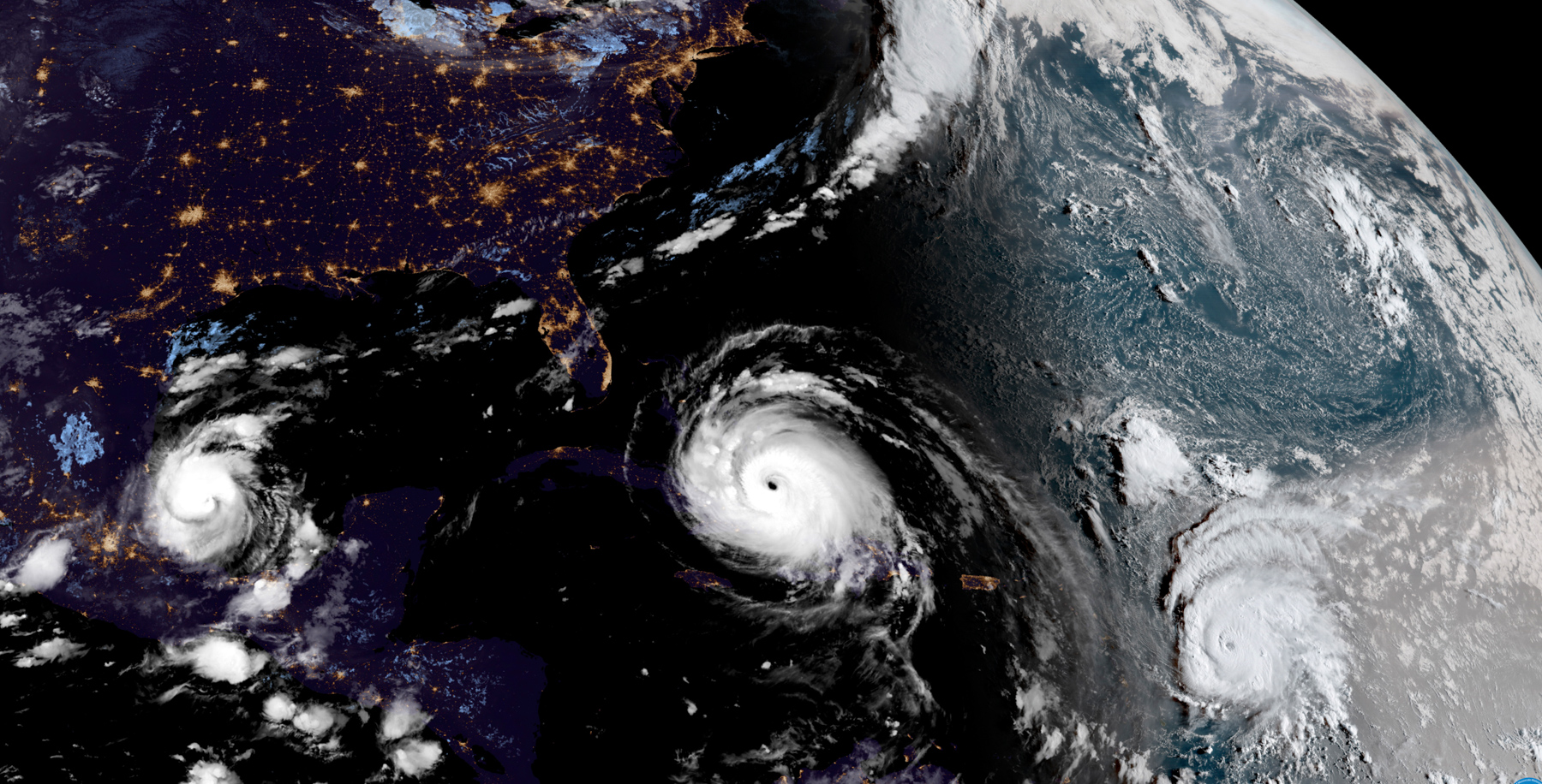
Currently, U.S. satellites are tracking a typhoon in the East China Sea and hurricanes in the Atlantic Ocean using big-picture data from space.
During the recent hurricanes Harvey and Irma, a new U.S. satellite, known as GOES-16, gave forecasters storm images like they’ve never seen before.
GOES-16 captured precise details every 30 seconds. It’s “really a quantum leap above any satellite NOAA has ever flown,” said Stephen Volz of the National Oceanic and Atmospheric Administration, the federal agency that with NASA operates the new satellite. GOES-16 joins a network of satellites that share data among 200 countries.
Before the first responders
Data and imagery from NASA has provided information to international partners on a range of weather situations:
- An earthquake in Chiapas, Mexico.
- Recent wildfires in Montenegro.
- Fires in South Africa.
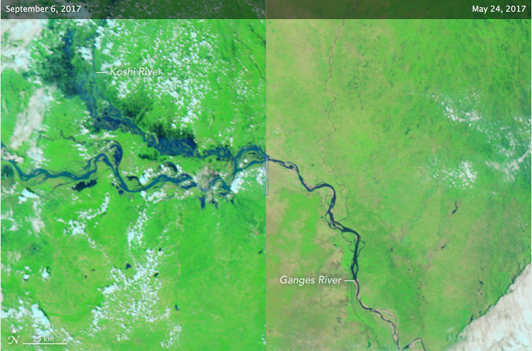
- Flooding in India.
Saving lives
Just as the U.S. shares specialized weather data, it also receives it from others. Since hurricanes Harvey and Irma struck the United States, Europe has been providing access to critical flooding maps and predictions through the Copernicus Emergency Management Service. Also, the U.S. disaster response system relies on data from European Space Agency satellites.


