So, the ‘Great Galactic Ghoul’ strikes again? This tongue-in-cheek entity is invoked by NASA scientists and engineers when missions experience difficulties, especially at Mars. After a seven month journey for ESA’s first ExoMars mission, contact with its Schiaparelli Lander was lost just before its scheduled touch-down on 19th October last year, although its Trace Gas Orbiter (TGO) successfully entered into orbit around the Red Planet and is functioning well. However, rather than the work of a cosmic ‘gremlin’, the apparent loss of Schiaparelli appears to have been due to incorrect data triggering a premature release of the lander’s parachute and cutting off its braking thrusters while still some 3.7km above the surface, resulting in a crash- rather than a soft-landing.
Mars has gained a bad reputation in the past, with fewer than half of the 40-plus missions sent there arriving safely and completing their mission successfully, especially in the early days of planetary exploration. Mars is not an easy target, particularly if you wish to land on its surface. Its thin atmosphere requires more than aero-braking and parachutes to slow a spacecraft down sufficiently for a soft landing. This has necessitated the use of thrusters or inflatable air-bags to ensure that landers arrive intact, making for complex automated procedures which have to function perfectly.
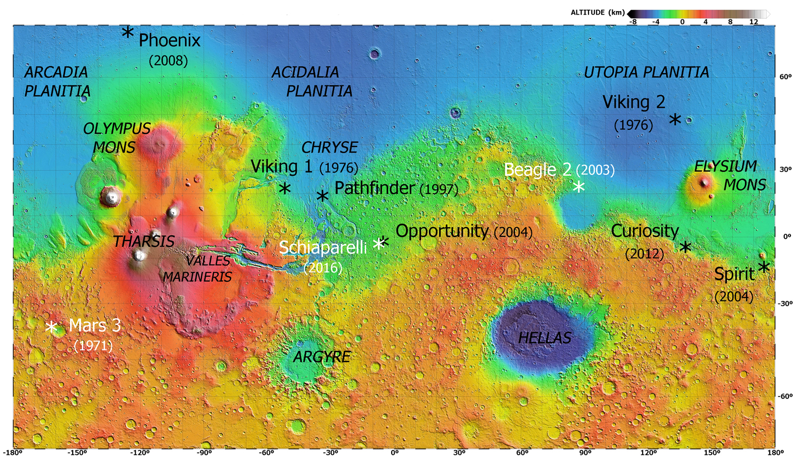
However, despite Schiaparelli’s silence, ESA’s latest orbital emissary joins a growing armada of spacecraft and landers operational at the Red Planet, more than ever before at any solar system body at any one time. These now comprise six orbiters and two rovers. ExoMars’ companions have all enjoyed spectacular success in their missions to help us understand present day conditions on Mars, as well as its past evolution.
A brief overview of these missions is given here, while ExoMars 1 is discussed in detail elsewhere in this issue of RocketSTEM.
MISSIONS CURRENTLY OPERATIONAL AT MARS AT TIME OF EXOMARS/SCHIAPARELLI ARRIVAL
| Project | Launch date | Agency/country | Type | Remarks |
| MarsOdyssey | 7 Apr 2001 | NASA/USA | Orbiter | Arrival at Mars on 24 October 2001.
Expected to remain operational until 2025 |
| Mars Express | 2 June 2003 | ESA/Europe | Orbiter | Arrival at Mars on 25 December 2003. Enough fuel to remain operational until 2026. |
| Opportunity (Mars Exploration Rover-B) | 8 July 2003 | NASA/USA | Rover | Landed 24 January 2004, usinga combination of parachute, thrusters and airbags.Stilloperating after over 12 Earth years. Its twin, Spirit, also greatly exceeded expectations, but ceased operating in March 2010. |
| Mars ReconnaisanceOrbiter (MRO) | 12 Aug 2005 | NASA/USA | Orbiter | Arrival in Mars orbit on10 March 2006, |
| Curiosity (Mars Science Laboratory) | 26 Nov 2011 | NASA/USA | Rover | Landed on 6 August 2012, using new sky crane system successfully. |
| Mangalyaan (Mars Orbiter Mission) | 5 Nov 2013 | ISRO/India | Orbiter | Entered Mars orbit on 24 September 2014
Primary mission completed – extension |
| MAVEN (Mars Atmosphere and Volatile EvolutioN) | 18 Nov 2013 | NASA/USA | Orbiter | Orbital insertion 21 September2014.
Mission extended until September 2018. |
Keeping a watchful eye — The orbiters
2001 Mars Odyssey
2001 Mars Odyssey has survived longer than any other spacecraft in orbit around a planet other than Earth and is the record holder for longevity among operational planetary missions, after the Voyagers and Cassini. Named ‘in tribute to the vision and spirit of space exploration as embodied in the works of renowned science fiction author Arthur C. Clarke’, and launched on 7th April 2001, it arrived at Mars on 24th October 2001.
The mission’s main goals have been to study and map the global distribution of different chemical elements and minerals that make up the Martian surface. The orbiter has also provided valuable information on the features and structure of the Martian surface and the processes which may have been active in creating these.
Odyssey has also sought to find evidence of present or past water and ice. One way of doing this is to determine the abundance of hydrogen in the shallow subsurface, and the probe’s studies led mission scientists to discover vast water ice deposits buried just below the surface in the Martian Polar regions.
Finally, the orbiter has conducted important measurements of Mars’ radiation environment. This is invaluable in helping to determine the likely health risks for human explorers.
Odyssey’s primary science mission ended in August 2004, since then the orbiter has fulfilled a series of extended missions. It broke the record for longest serving spacecraft at Mars on 15th December 2010, and continues to study Martian geology and climate, as well as serving as a communications relay for the rovers on the planet’s surface. The spacecraft is in good shape and could continue operating until 2025.
Mars Express
Mars Express, named for its rapid and streamlined development, was ESA’s first spacecraft to visit another planet in the Solar System. Having deployed the UK’s Beagle-2 lander five days previously, it entered orbit around the Red Planet on 25th December 2003. As with the current ExoMars mission, contact with the lander was lost, although it was identified, partially deployed on the surface, in images from NASA’s Mars Reconnaissance Orbiter early in 2015.
At the time of its arrival, Mars Express was going to carry out the most detailed and complete exploration of Mars ever done. It was the first to conduct a thorough search for water on the Red Planet, from below ground and up into the atmosphere. The scientific objectives of the mission include detailed global high-resolution photo-geology of the planet, besides geochemical and mineralogical mapping of its surface, and even studies of the near sub-surface in the search for permafrost. Its suite of instruments is also designed to study atmospheric composition, global atmospheric circulation and surface-atmosphere interaction, as well as interaction of the atmosphere with the interplanetary medium.

This very successful mission – coming up for 13 years – has produced a wide range of significant results, some of its main achievements being the detection of hydrated minerals, including phyllosilicates (clays), the identification of recent glacial landforms, and most intriguingly the possible detection of methane in the atmosphere. This latter phenomenon is one of the main targets for study of ExoMars Trace Gas Orbiter.
Beyond its ongoing science mission, Mars Express also forms, with the NASA orbiters, part of a communications infrastructure currently active at Mars for other missions. Because of its great success, ESA has extended the mission for a further two years, until 2018. This will give the High Resolution Stereo Camera (HRSC) on board more opportunities to record the entire surface of Mars in high resolution, colour and, above all, in 3D.
Mars Reconnaissance Orbiter (MRO)
NASA’s Mars Reconnaissance Orbiter was launched in 12th August 2005, on a quest for evidence that water may have been present on the Martian surface for a long period of time. While other Mars missions have shown that water did indeed flow across the surface at various times during the Red Planet’s history, it remains a mystery whether water was ever around long enough to provide a habitat in which life could originate and develop.
In its survey of Mars, MRO is looking particularly at small-scale features. One of its cameras – the High Resolution Imaging Science Experiment (HiRISE) camera – is the largest ever flown on a planetary mission, and has a resolution of just 0.3 m per pixel from a height of 300 km. ‘Though previous cameras on other Mars orbiters could identify objects no smaller than a school bus, this camera can spot something as small as a dinner table…. Its imaging spectrometer could identify key (water-related) minerals in patches as small as a swimming pool at a few thousand carefully chosen sites, while covering the whole planet at a resolution of 200 meters (650 feet)’ (NASA Fact Sheet).
The spacecraft is more than its camera though, and carries six science instruments for examining Mars in various parts of the electromagnetic spectrum from ultraviolet to radio waves. (Two other investigations use the spacecraft movements as a means of sounding out both the atmospheric structure and internal structure of the planet.) Their main goals, among others, are to identify deposits of minerals of aqueous origin, which could have formed in water over long periods, and also to look for evidence of ancient shorelines, and erosion and deposition carried out by flowing water.

MRO’s studies have found evidence of a variety of past watery environments – including clay minerals, carbonates, hydrated silica and sulphates – and have shown that Mars is more diverse and dynamic than previously thought. Excitingly, some of the minerals detected in Martian surface rocks appear to have formed with the right pH and sufficient water to permit life to develop, if it was ever able to start.
Cameras on Mars orbiters have taken thousands of images that have enabled scientists to build a more comprehensive history of Mars’ geology and atmosphere. While most landscapes don’t appear to have changed much in millions of years, MRO’s cameras are enabling us to see rapid or seasonal changes at the local scale, including recently discovered transient activity involving salty liquid water. Studying such processes can help determine how the landscape has evolved, and may help us understand better the circulation of volatiles, such as water and carbon dioxide ices and gases.
In addition to conducting its own science mission, Mars Reconnaissance Orbiter has also been useful in the selection of landing sites for future missions, its capability allowing it ‘to identify obstacles such as large rocks that could jeopardize the safety of landers and rovers, including the Phoenix mission and Mars Science Laboratory mission.’ Like Mars Odyssey, it also serves as a communications relay satellite for lander and rover missions such as MSL Curiosity. Having fulfilled its planned science goals during its two-year primary science mission, it is now in its fourth mission extension, and could remain a key element in NASA’s Mars Exploration Program fleet for a number of years yet.
India’s Mars Orbiter Mission — Mangalyaan
Named ‘Mangalyaan’, from the Sanskrit for ‘Mars-Craft’, the Mars Orbiter Mission is India’s first interplanetary mission. On 24th September 2014, the Indian Space Research Organisation (ISRO) became the fourth space agency to reach Mars, making India the first Asian nation to reach Mars orbit, as well as the first nation in the world to achieve this at its first attempt, and on a modest budget of only $73 million!
Mangalyaan is a technology demonstration project, aimed at developing the technologies needed for designing, planning and carrying out interplanetary missions. The spacecraft also has a science payload, consisting of a colour camera, which has returned many stunning and detailed images, and other scientific instruments for studying the morphology and composition of surface features, as well as the Martian atmosphere.
While MOM has not delivered many new science results as yet, the mission itself is considered a big success, as all of its engineering goals have been achieved, and the spacecraft has outlived its expected lifespan. ISRO will certainly be able to embark on future interplanetary missions with confidence.
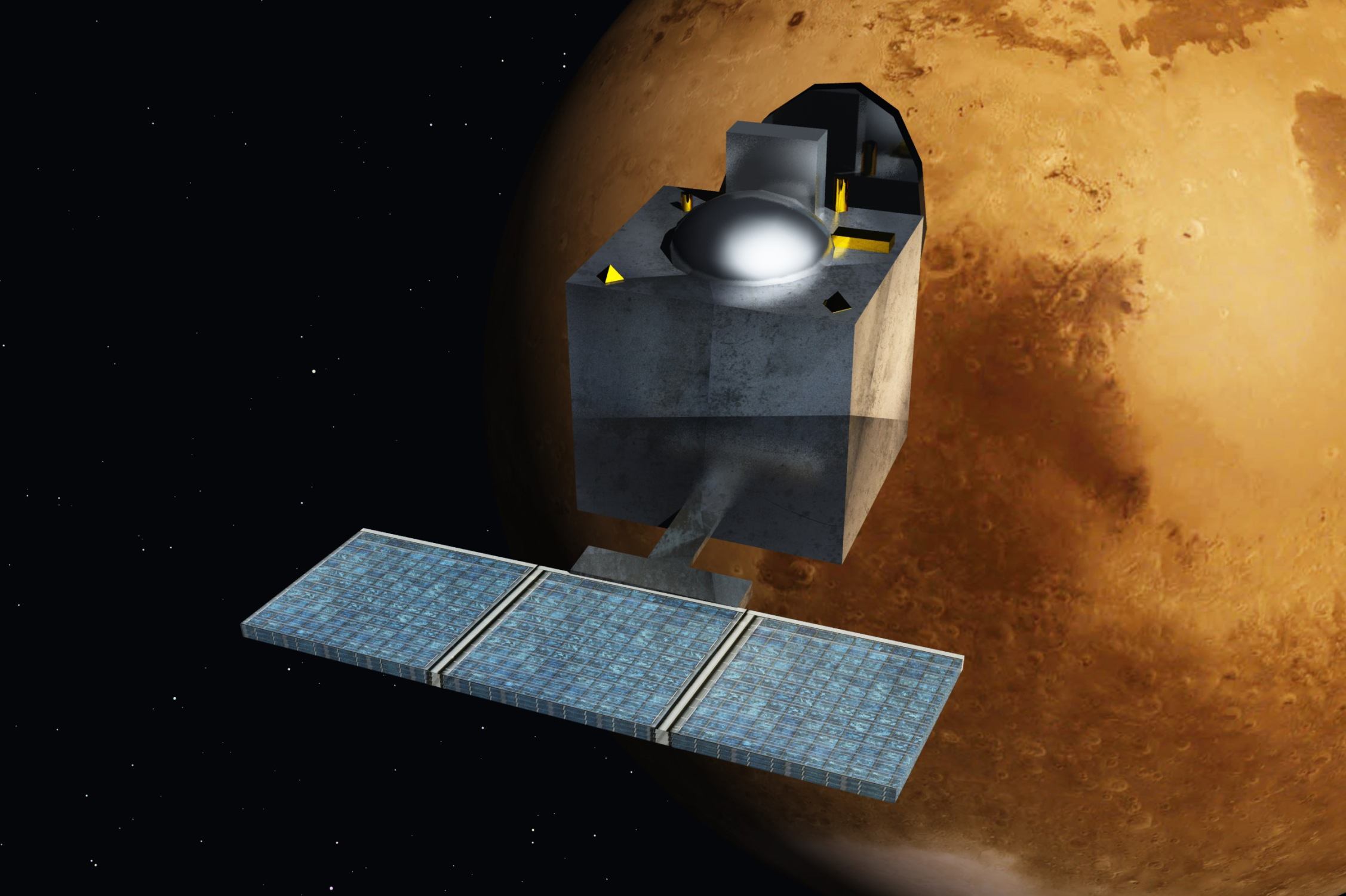
MAVEN – The search for Mars’ lost atmosphere
Launched in November 2013, the Mars Atmosphere and Volatile EvolutioN (MAVEN) spacecraft is the first one dedicated to exploring the Red Planet’s tenuous upper atmosphere. Its main aim is to try and help scientists understand the climate history of the planet. Key goals for investigation are the role of the solar wind in stripping away the atmosphere, its current state and rates of gas loss to space today. By then extrapolating back through time, scientists will be able to determine the evolution of Martian climate, the total atmospheric loss over Mars’ history, and whether the planet has ever been (or is!) able to support life.
As of 3rd October last year, MAVEN had completed one Mars year of science observations (just under two Earth years). Among the many significant discoveries and science results so far achieved is the most detailed characterisation to date of the structure, composition, and variability of the planet’s upper atmosphere. The spacecraft has also enabled scientists to make the most accurate estimation yet of the rates of past and current atmospheric loss to space, and how this is related to the action of the solar wind and major Sun-storm events. This gas loss would appear to have been the major factor in the transformation of Mars’ climate from a warm, wet one to the frigid, dry conditions we observe today.
NASA has declared MAVEN’s primary mission successful, its proposed science objectives achieved, and approval has been given for a two-year extended mission until the end of September 2018.

Landers and Rovers
Mars Exploration Rover (MER) — Opportunity
Named by the winners of a student essay contest, Opportunity and its companion rover Spirit arrived on the surface of Mars in January 2004. Armed with a complex array of cameras, scientific instruments and a rock abrasion tool, and powered by solar panels and radio-isotope heater units, their main scientific goal was to search for and characterize a wide range of rocks and soils that might provide evidence of past water activity on Mars. While the Mars Exploration Rovers were not equipped to detect life directly, their search for evidence of past water could help establish the potential habitability of the environment in the planet’s history. The rovers’ target sites – on opposite sides of Mars – were considered likely to have been affected by liquid water in the past. Spirit went to Gusev Crater, a possible former lake in a giant impact crater. Opportunity targeted Meridiani Planum where mineral deposits indicative of a humid past had been identified from orbit, particularly by Mars Global Surveyor and Mars Odyssey.
The MER rovers also had the task of calibrating and validating surface observations made by Mars Reconnaissance Orbiter instruments, so as to help determine the accuracy and effectiveness of instruments surveying Martian geology and surface composition from orbit.
Both rovers greatly exceeded their original primary 90-sol missions (one sol = one Martian day, or the equivalent on Earth of 24 hours 39 minutes 35 seconds), surpassing their science mission objectives, and capturing the public imagination on their slow but epic journeys across the Martian surface. Spirit became stuck in sand in late 2009 and eventually fell silent on Sol 2210 (March 22, 2010), having covered a distance of 7.73 km (4.8 miles), visiting a number of craters, climbing and exploring the Columbia Hills and surviving dust storms.
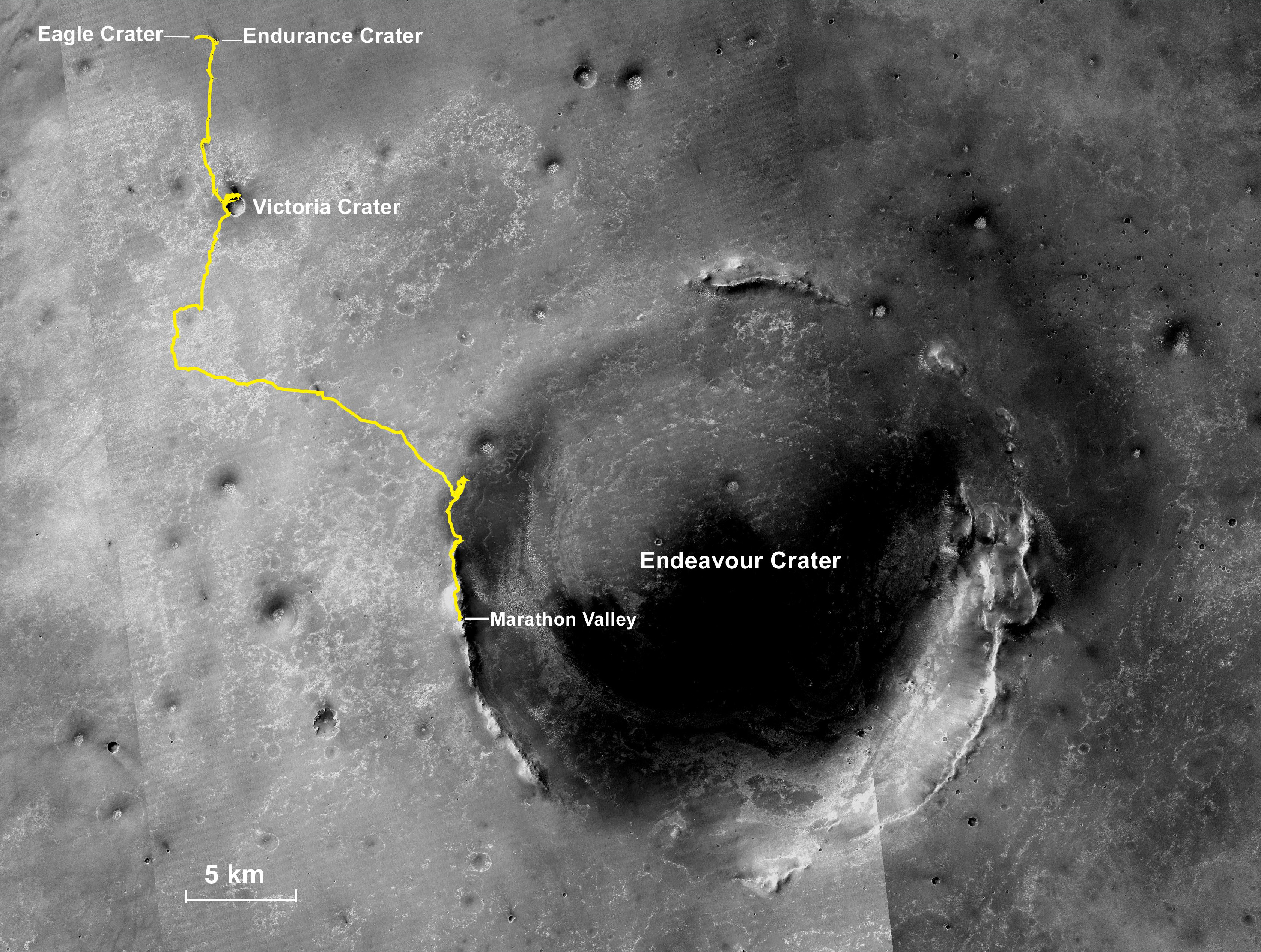
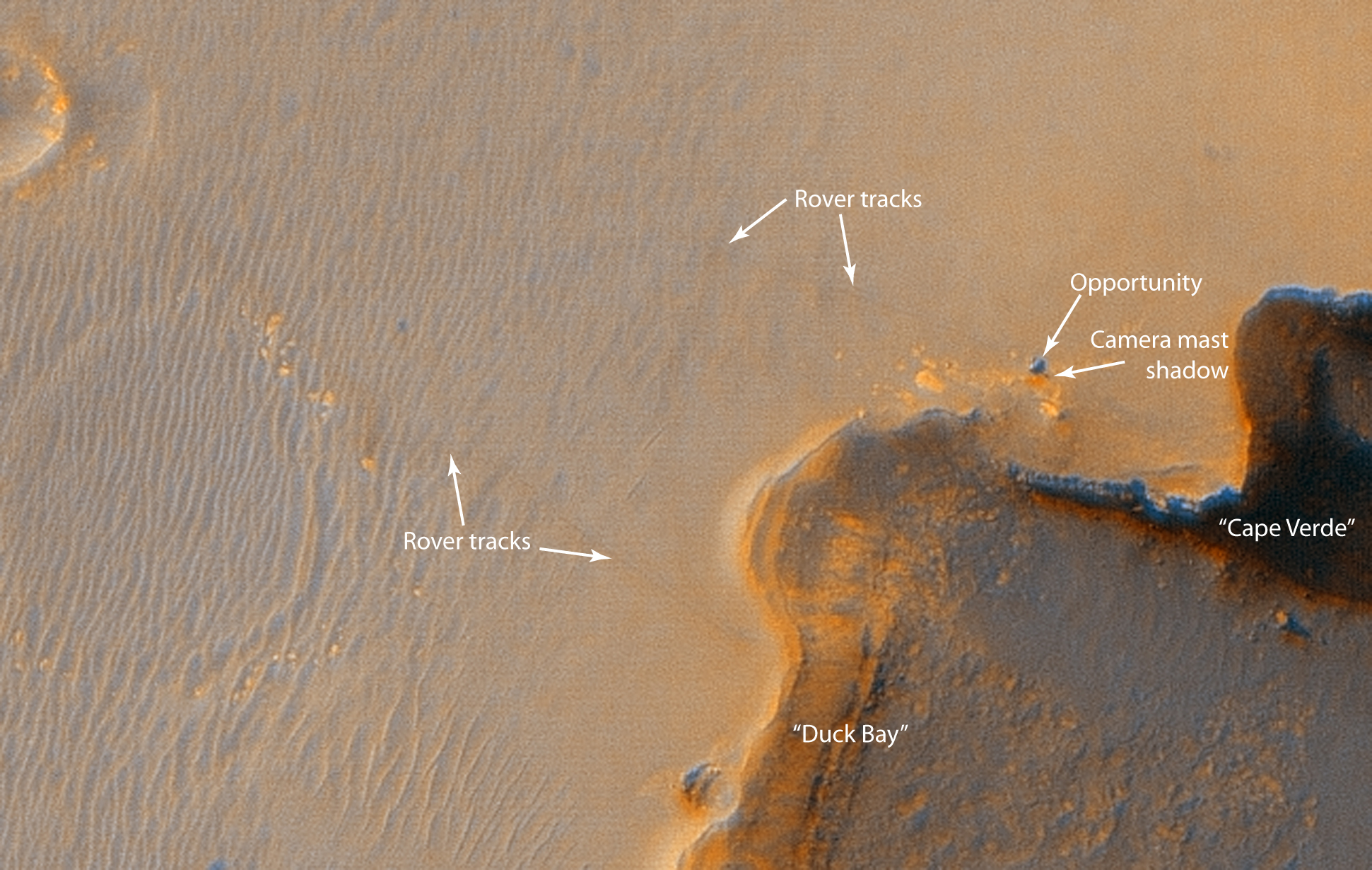
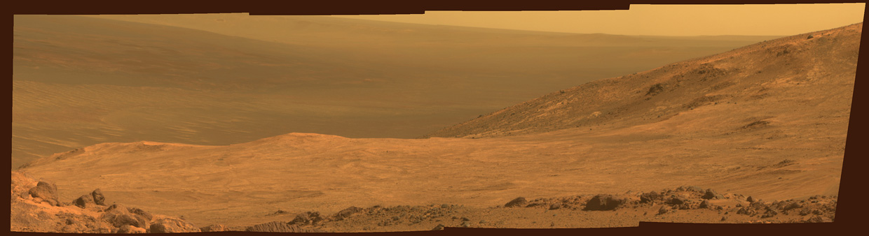
Having completed its ‘marathon’, covering over 43 km (27 miles) to date, Opportunity is still operational. Having visited Endurance Crater and the 800m-wide (half-mile) Victoria Crater (where it spent two years), it is now located at ‘Spirit Mount’ on the rim of the 22 km (14 mile) diameter Endeavour Crater, the first science target of its 10th extended mission phase. Here it continues to analyse the type and composition of rock samples, and seeking to confirm the past importance of water on Mars. Like Spirit, it has also made astronomical observations and obtained atmospheric data.
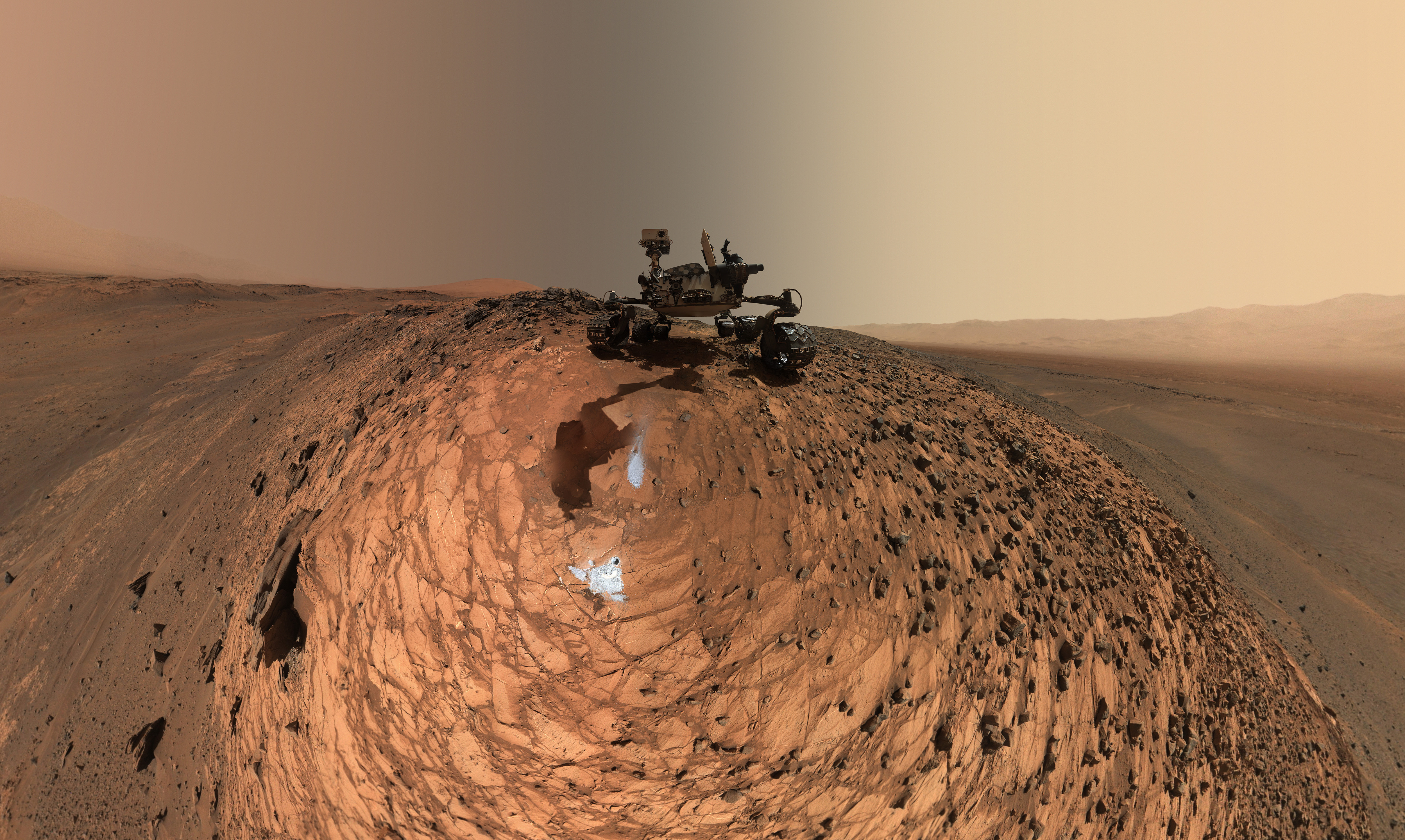
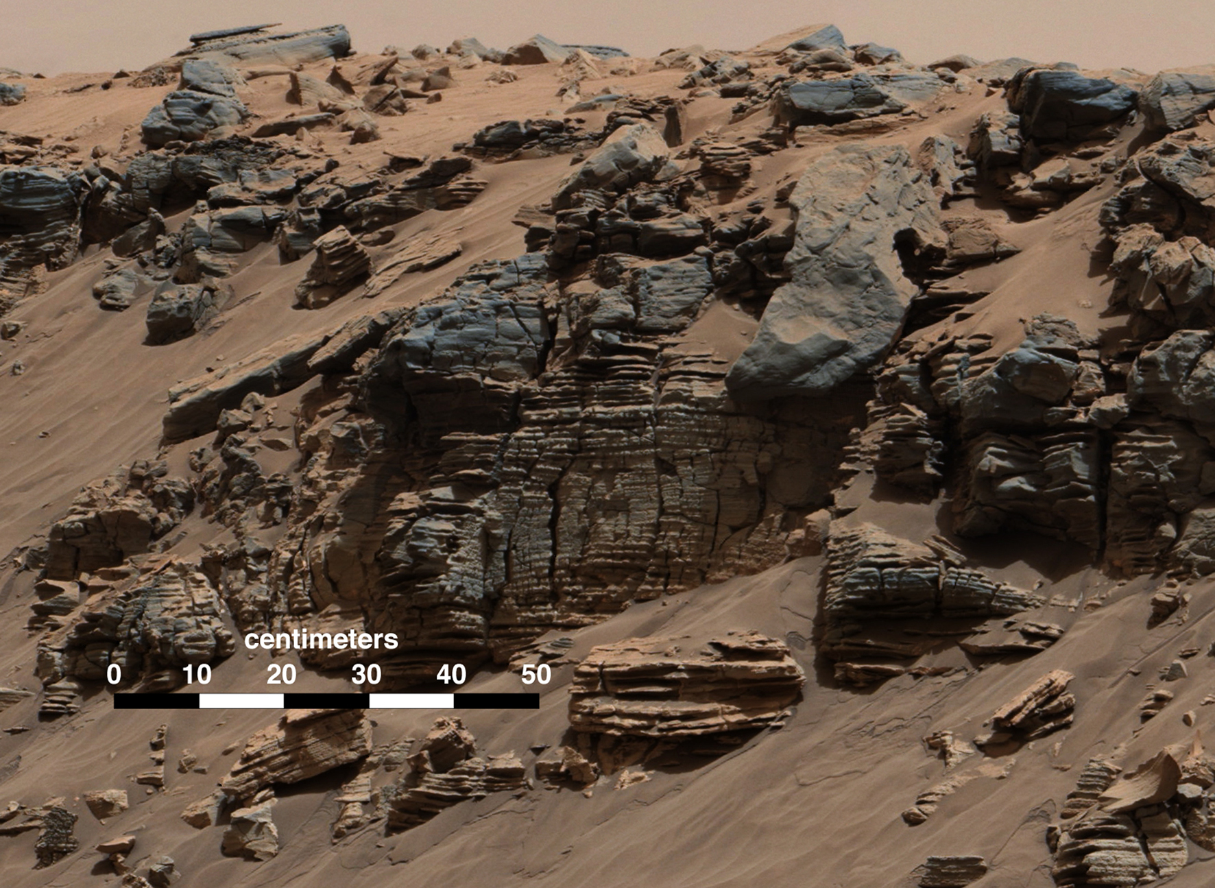
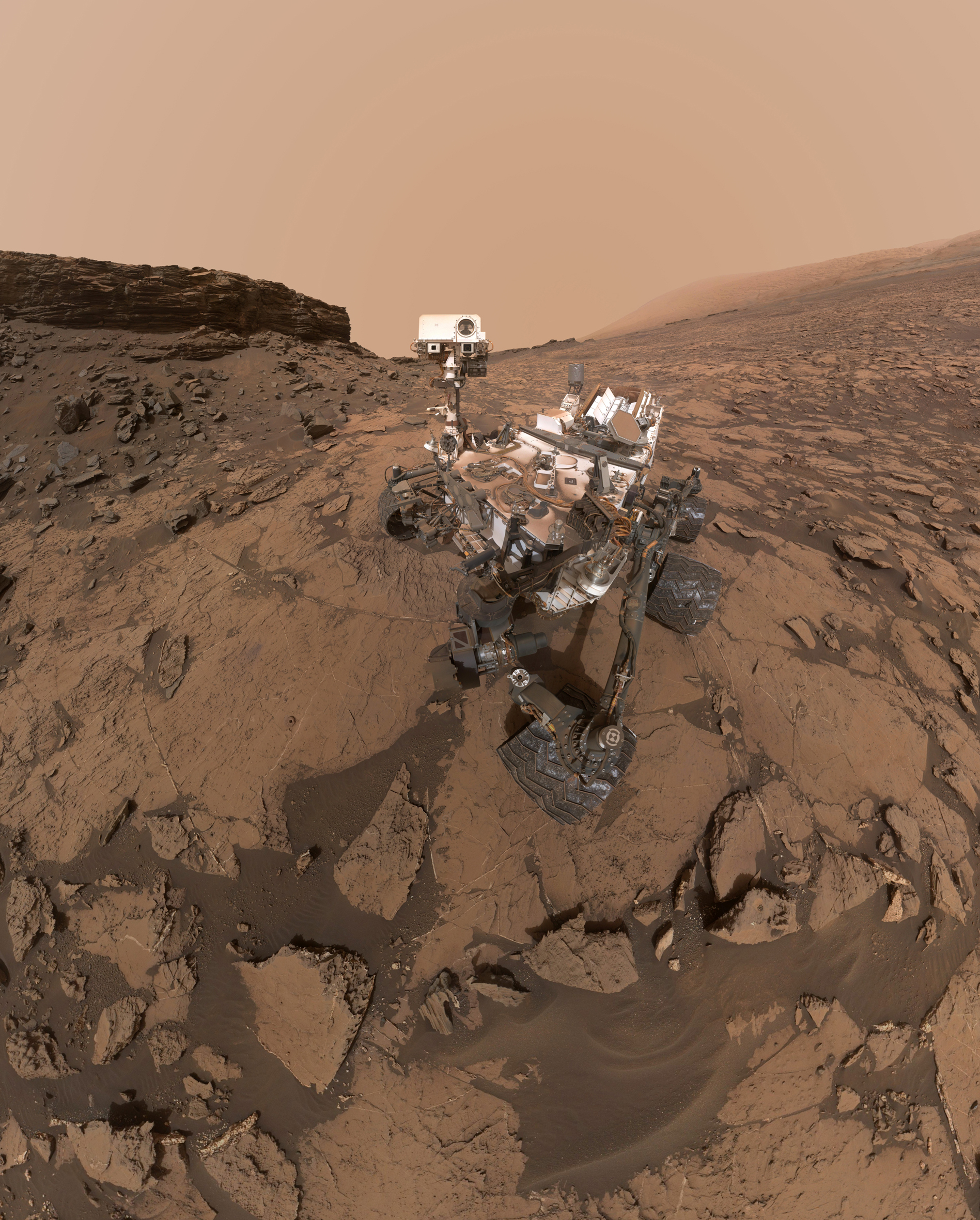
Mars Science Laboratory – Curiosity
Few of us who followed the arrival of NASA’s Mars Science Laboratory (MSL) at the surface of Mars on the 6th August 2012 will forget the so-called ‘seven minutes of terror’, as this 899 kilogram (1,982 pound) car-sized wonder was delivered to the Martian surface by the new ‘sky-crane’, in one of the most complicated spacecraft landings ever attempted. Its target was Gale Crater, a suspected former lake location with a 5 km-high (3 mile) mountain of layered materials – named Aeolis Mons or ‘Mount Sharp’ – in its centre. Studies from orbit had revealed different mineral compositions of these layers, depending on their height, and the possibility that these might hold a record of two billion years of Martian history. There are also flow channels in this target study area.
With its rover named Curiosity, the MSL mission is part of NASA’s Mars Exploration Programme, the goal of which is to determine the planet’s habitability and to try and discover whether or not it has ever had an environment able to support microbial life. Curiosity is designed to collect data on all aspects of its surroundings – geological, chemical, atmospheric, water, radiation – and is also looking out for signs of organic compounds, as well as any features that might show evidence of biological processes.
To do this, the rover is equipped with the largest, most advanced suite of scientific instruments ever landed on the Martian surface, and it is more mobile and flexible than previous rover missions. Curiosity analyses in its on-board laboratory samples scooped up from the soil and drilled from rocks. This is helping to assess the past Martian environment through the structure and chemical composition of rocks and soils.
So far, the rover has been spectacularly successful. For instance, it has identified a range of sediments of aeolian (wind), lacustrine (lake) and fluvial (stream or river) origin, the latter confirming the importance of water in the past evolution of the floor of Gale Crater and lower slopes of Mount Sharp explored so far. As part of its two-year mission extension that began on 1st October, it is now continuing to head uphill, towards areas containing more minerals associated with past water action.
The MSL mission also had the goal of demonstrating the ability to land a very large, heavy rover on the surface of Mars, using radical new ‘sky-crane’ technology. Landing large payloads will be necessary for any future Mars Sample Return mission to collect rocks and soils and send them back to Earth. Such a mission is the proposed next stage in the Mars Exploration Programme. Curiosity is also providing useful data for use in future manned missions, as are all of the spacecraft and landers operating at the Red Planet.
What next?
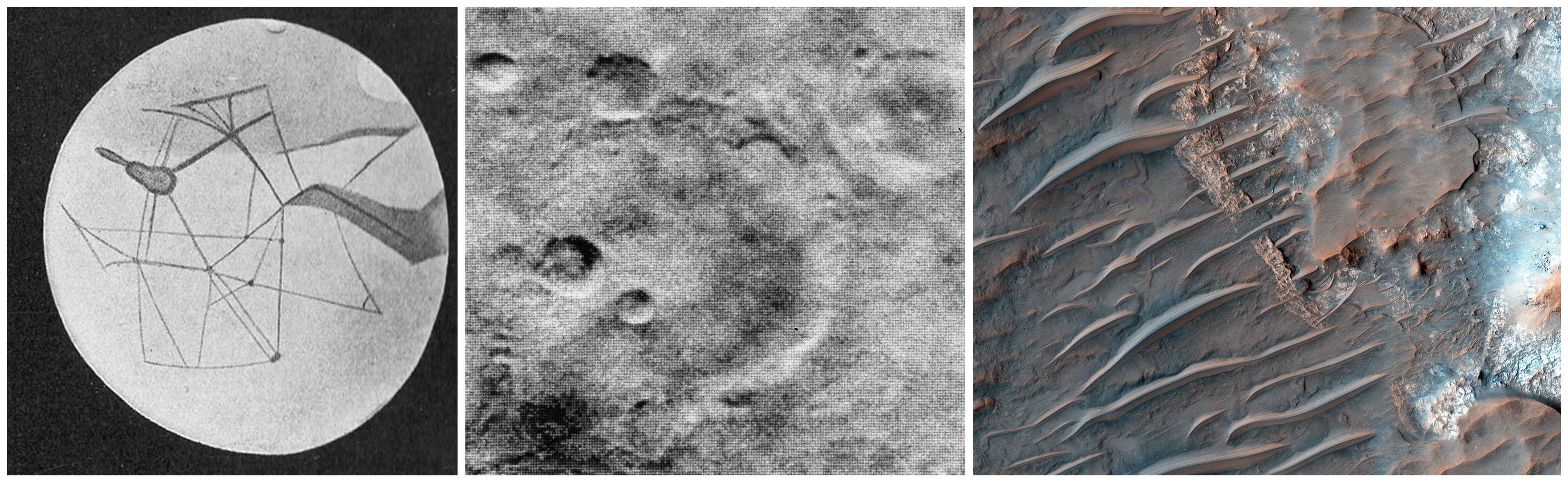
We have long since dispelled Percival Lowell’s dreams of Martian civilisations, inspired by the 19th century works of Giovanni Schiaparelli and Camille Flammarion. Their maps, based on telescopic observations of the time, had shown ‘canali’ – channels, natural or artificial –which ultimately proved to be spurious optical illusions, as did those seen by Lowell himself. And we have come a long way from the grainy photos of Mars taken by the early missions of the 1960s, although many astronomers still believed up to this time that there might be some form of hardy life on this tantalising world.
The missions currently active at Mars have helped provide us with an increasingly detailed understanding of the planet’s atmosphere, surface environment, history of water, and potential for life. Hopefully, finances will enable them to continue to explore for as long they are healthy and functioning.
Looking ahead, despite the failure of Schiaparelli, ESA member states agreed, at a council meeting in December, to fund the extra €436 million ($466 million) needed to ensure delivery of the second stage of the two-part Exomars mission, which is due to land a rover on the Red Planet in 2021 to drill into the Martian soil and look for biochemical traces of living or fossil organisms.
As for NASA, its FY 2017 Budget Request kept on track its Mars 2020 rover plans, although it now remains to be seen where the priorities of the new Administration will lie. Before this, in 2018, we hope to see the launch of InSight (Interior Exploration using Seismic Investigations, Geodesy and Heat Transport), the first mission dedicated to investigating the deep interior of Mars. Although originally scheduled to launch in March 2016, a vacuum leak in its main seismometer instrument meant it will now have to await the next suitable launch-window for Mars.
However, cuts to planetary science budgets – despite recent spectacular successes, not only at Mars, but across the Solar System from Ceres to Saturn and beyond to Pluto – mean that we might not see such a golden age of robotic exploration again for a while. And the manned exploration of the Red Planet still looks far off for now. In the meantime, these orbiters and rovers, now hardy veterans, will continue to be our pioneering emissaries at the Red Planet.
To find out more on the current Mars missions, their science payloads and discoveries, visit:
https://www.nasa.gov/mission_pages/mars/main/index.html
http://www.esa.int/Our_Activities/Space_Science/Mars_Express
http://www.isro.gov.in/pslv-c25-mars-orbiter-mission


